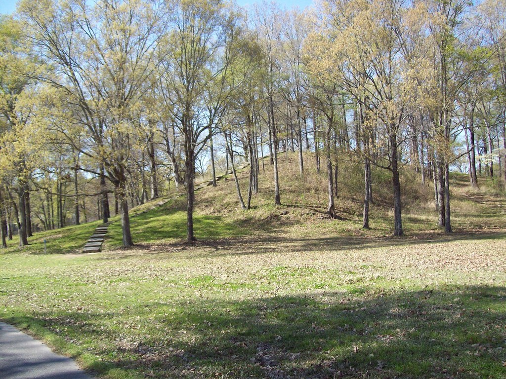
Stand on the flat floodplain of northeastern Louisiana, near the small town of Epps, and the land looks unremarkable at first. Then you notice the shape of it. The ground rises in long, curving ridges, and above the trees looms a grassy mound more than twenty metres high. This is Poverty Point, and it was built more than 3,000 years ago by people who did not farm, did not use the wheel, and did not keep domesticated animals — yet they raised one of the largest earthworks in North America.
The site was built between about 1700 and 1100 BCE, during the Late Archaic period. Its builders are known to archaeologists as the Poverty Point culture, because the name the people gave their own home is lost. The modern name comes from a nineteenth-century plantation established on the land in the 1840s by Philip Guier, who called his holding Poverty Point. The people who raised the mounds remain anonymous, but what they left behind speaks for them.
A City Made of Earth
The heart of Poverty Point is a great semicircle of six nested, C-shaped earthen ridges, opening towards a broad, flat central plaza. The ridges stand about two metres high and are separated by wide, flat swales. Radiocarbon dates suggest that most of the ridges were built between about 1600 and 1300 BCE, though the site was in use for centuries. Five or six mounds stand in and around the ridge complex, each with its own shape and, probably, its own purpose.
The largest is Mound A, sometimes called the Bird Mound because its outline, seen from above, has been described as resembling a bird in flight. It rises about 22 metres (72 feet) above the plain, measures roughly 216 by 201 metres at its base, and covers about eight acres. It is the second-largest earthen structure in North America, surpassed only by Monks Mound at Cahokia, which was built some two thousand years later. Mound A alone is estimated to contain some 240,000 cubic yards of earth, all of it moved by hand, basket by basket.
Altogether, the builders of Poverty Point moved an estimated 750,000 cubic metres of soil — nearly a million cubic yards. There were no carts, no draught animals, and no metal tools. The work was done with digging sticks, baskets, and human hands, over generations. Whatever Poverty Point was, it was not a casual undertaking. It was a project that demanded organisation, planning, and a shared purpose sustained across centuries.
The People Who Did Not Farm
What makes Poverty Point so startling is who built it. The people of the Poverty Point culture were hunter-fisher-gatherers. They hunted deer and small game, fished the rivers and bayous, and gathered nuts, seeds, and fruit from the rich floodplain of the Lower Mississippi Valley. They did not practise agriculture, and they made no pottery. For generations, archaeologists had assumed that monuments on this scale could only be raised by farming societies, whose stored surpluses could feed large workforces. Poverty Point proved that assumption wrong.
The settlement was, at its height, the largest community in North America of its time. Some archaeologists have described it as America’s first city, a phrase that captures its scale and complexity even if the term “city” is debated. Houses stood on the ridges — archaeologists have found postholes and hearths there — and the plaza in the centre was kept open, probably for gatherings and ceremonies. The mounds were not used for burial, and no single mound has been identified as a ruler’s tomb. Their purposes remain open to interpretation.
One of the most remarkable features of the site is its trade network. Stone was scarce in the Mississippi floodplain, yet the people of Poverty Point imported raw materials from hundreds of kilometres away: copper from the Great Lakes region, lead ore from Missouri, quartz crystal and novaculite from the Ouachita Mountains of Arkansas, soapstone from Georgia and Alabama, and slate and sandstone from elsewhere. These materials were worked into tools, ornaments, and the distinctive baked-clay cooking balls known as Poverty Point objects, which were heated in fires and used to cook food in earth ovens. The exchange network was the largest and most complex in North America at the time, and it suggests a society that was anything but isolated.
Discovery and Recognition
The mounds were known to local people for a long time. The site was recognised as a Native American settlement as early as the 1830s, and the mounds were investigated by the antiquarian Clarence B. Moore in the early twentieth century. But the ridges themselves were not recognised as artificial structures until the 1950s, by which time they had been repeatedly ploughed for farming. Serious archaeological study began in earnest only after that, under researchers such as Clarence Webb and James A. Ford.
Recognition followed. Poverty Point was designated a National Historic Landmark in 1962. On 22 June 2014, the UNESCO World Heritage Committee inscribed it as a World Heritage Site at its meeting in Doha, Qatar, under the official name “Monumental Earthworks of Poverty Point”. It became the first World Heritage Site in Louisiana and the twenty-second in the United States. The designation placed a hunter-gatherer earthwork on the same list as the Taj Mahal, the Statue of Liberty, and the Great Barrier Reef.
It is worth noting that Poverty Point was long thought to be the oldest mound complex in the United States. That distinction passed in the 1980s to Watson Brake, another site in the same region of Louisiana, which has been dated to about 3500 BCE. Poverty Point remains, however, by far the larger and more complex of the two.
The Clay Balls and the Objects of Daily Life
Among the most distinctive finds at Poverty Point are the small, hand-shaped objects of baked clay known as Poverty Point objects. They come in dozens of shapes — balls, cylinders, cones, and grooved forms — and they were heated in fires and dropped into earth ovens or skin-lined pits to cook food. Thousands of them have been found, and they are so closely associated with the site that they have become its signature artefact. They are also a reminder that the people of Poverty Point cooked without pottery, using stone and clay in ways that worked.
Other finds tell a quieter story about daily life. Stone beads and pendants, carved from imported jasper, slate, and hematite, suggest personal ornament and status. Small, polished stone axes, drills, and spear points show a community skilled in working materials that had travelled hundreds of kilometres to reach them. Tiny clay figurines — some of them shaped like women — have been found in small numbers, and their meaning is unknown. No two are alike, and no one has yet explained what they were for. They are small, strange, and entirely human: objects made by people who wanted to make something more than a tool.
Why Was It Abandoned?
Around 1100 BCE, the people of Poverty Point left. The site was abandoned, and the reasons are not known. No evidence of invasion, disaster, or epidemic has been found. Some archaeologists have suggested that changes in the Mississippi River’s course altered the floodplain and its resources; others point to gradual social or environmental change. The honest answer is that the record is silent, and the abandonment remains one of the site’s enduring puzzles.
The ridges and mounds survived because they were made of earth, and earth endures. Today the site is preserved as the Poverty Point World Heritage Site and State Historic Site, a 470-acre park on Bayou Macon where visitors can walk the ridge trail, climb Mound A, and look out over the landscape the builders shaped. A museum on the site displays the stone tools, ornaments, and clay cooking balls recovered from excavations, including objects whose raw materials travelled farther than most of the site’s builders ever did.
What Is Known — and What Is Not
Documented facts: Poverty Point was built between about 1700 and 1100 BCE by hunter-fisher-gatherers of the Late Archaic period. Its core is six concentric, C-shaped ridges around a central plaza, with several mounds, including Mound A — about 22 metres high and the second-largest earthen structure in North America. Roughly 750,000 cubic metres of earth were moved by hand. Raw materials were imported from hundreds of kilometres away. The site was designated a National Historic Landmark in 1962 and inscribed on UNESCO’s World Heritage List on 22 June 2014. It was abandoned around 1100 BCE.
Unverified or open to interpretation: The exact purpose of the mounds and ridges is unknown; they were not burial mounds, and suggestions that they served ceremonial, astronomical, or residential purposes are interpretations, not established fact. The idea that the layout reflects a deliberate “sacred geometry” is a hypothesis advanced by some writers, not a documented feature. The name of the people who built the site, and what they called it, is unknown. The reasons for the site’s abandonment around 1100 BCE remain unexplained. Claims that Poverty Point was “America’s first city” are a modern description used by some archaeologists, not a fact recorded by its builders.
Poverty Point endures as a rebuke to easy assumptions about the past. The people who built it had no farms, no wheels, and no writing, yet they organised a workforce, moved a mountain of earth, and sustained a trading network that spanned a continent. They did not leave their name behind. They left something larger: a landscape rearranged by human hands, still visible more than three thousand years later.